

File:AreoleProvinces.png

Size of this preview: 800 × 566 pixels. Other resolutions: 320 × 226 pixels | 640 × 452 pixels | 1,024 × 724 pixels | 1,280 × 905 pixels | 2,560 × 1,810 pixels | 3,508 × 2,480 pixels.
Original file (3,508 × 2,480 pixels, file size: 1.27 MB, MIME type: image/png)
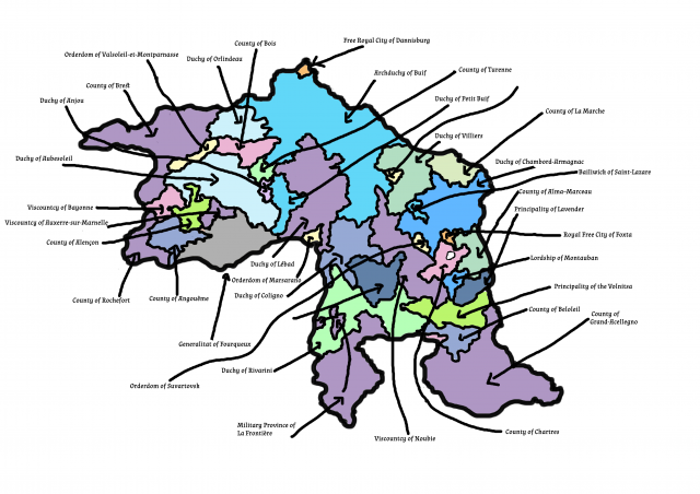
Map of the various duchies, counties, vicouhties, orderoms, etc, that make up the Kingdm of Aréole. Those estats in purple are directly owned by the Crown.
File history
Click on a date/time to view the file as it appeared at that time.
| Date/Time | Thumbnail | Dimensions | User | Comment | |
|---|---|---|---|---|---|
| current | 01:56, 2 February 2024 | | 3,508 × 2,480 (1.27 MB) | De Remuva (talk | contribs) |
You cannot overwrite this file.
File usage
The following page uses this file: